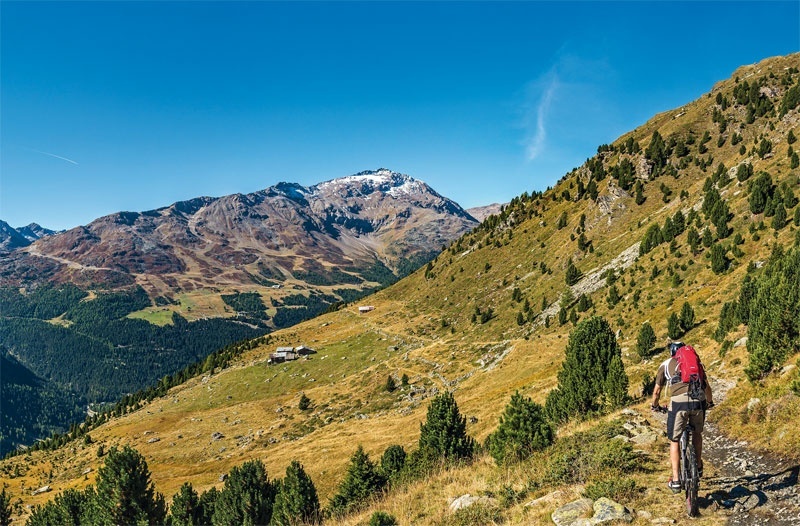
The starting point is from the Rifugio dei Forni 2180 m on the dirt road to Rifugio Pizzini sign Way n. 555, which turns northeast onto two steep switchbacks. On the first straight stretch outside the wood we find a diversion indicating the right direction of our itinerary n. 527 sign with indication Baite Ables, Confinale, Caval laro 2320 m. You turn decisively westward on an almost flat dirt road, pass over Predaccio mountain huts sign with the first indication of the Way n. 527, and cross Val Manzina on a bridge. Here begins the trail, which repre sents the only short but challenging stretch to overcome. Then you reach the beautiful Baite dell'Ables 2240 m, whence the descent starts along the Track n. 571.1 through Ceisa di Sotto. You can also head downhill the length of the Track n. 573. To be also pointed out that you have possibility to cover the stretch going from Baite dell'Ables to Baite Confinale above the tree line sign Way n. 527 and then to descend towards Santa Caterina Valfurva on the Track n. 568 this is a 10 km alternative road or even to proceed downhill to Baite Cavallaro and get to Sant'Antonio Valfurva.
I Forni le Baite dell'Ables
Itinerary details

Associated itinerary slider title
Associated itinerary slider description
Find your stay, events, services, passes, forecast & webcams
Trying to organise your holiday in Bormio? We've put all the information you need in one place: from which mountain passes are open (so you can plan your journey), to our guide to what's on during your stay, information on which lifts are open, and the opening times for QC Terme Bormio and Bormio Terme. You can also find a list of local restaurants and equipment rental shops.
